Interns and Projects
The following are projects I have done while being an intern for companies or a research assistant.
- 1. Intern as Machine Learning Researcher at Siemens
- 2. Research Assistant on an NSF Project - KnowWhereGraph
- 3. Research Assistant on an NSF Rapid Grant
- 4. Research Assistant on an NSF Project - Open knowledge Network
1. Intern as Machine Learning Researcher at Siemens
In this project, I focused on knowledge graph completion and query answering by using knowledge graph embedding (KGE) methods. A common assumption in KGE is that similar entities are more likely to play similar relational roles or share similar local graph structures. However, previous works usually rely on triple-level structural information while ignoring long-term relational dependencies between entities. Inspired by Transformer in capturing long-term dependencies between words in sentences, I developed a transformer-based embedding model to capture relational dependencies for knowledge graph completion. The main difference lies in that relational roles of entities should be incorporated instead of pure entity connections (corresponding to word proximity in sentences).
2. Research Assistant on an NSF Project - KnowWhereGraph
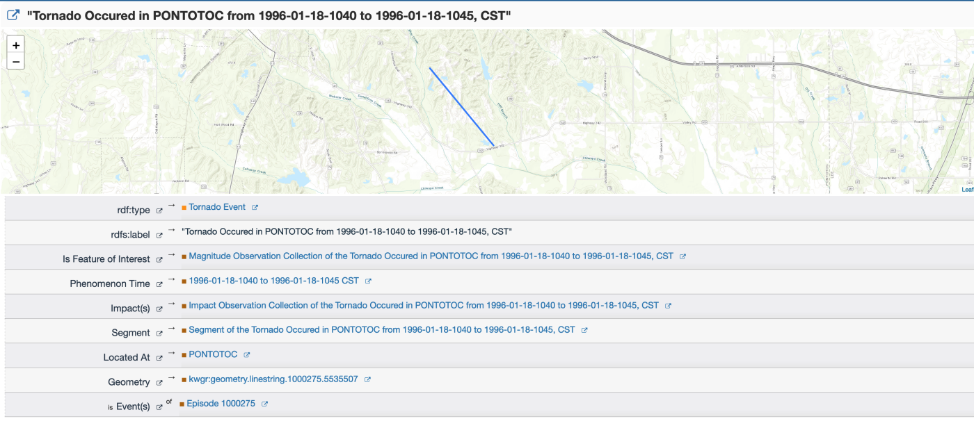
The goal of this project is to improve data-driven decision making and data analytics, specifically data analytics that involve geographic data. This project will create the “KnowWhereGraph” – a knowledge graph tool that specifically enables other data-analysis knowledge tools that have a geospatial component. Two core components in our “KnowWhereGraph” are a seed knowledge graph that contains a wide range of integrated datasets at the human-environment interface (e.g., soil, hydrology, humantarian relief), and a series of geospatial enrichment services on top of our graph for a wide range of applications in environmental intelligence by giving decision-makers and data analysts on-demand access to area briefings.
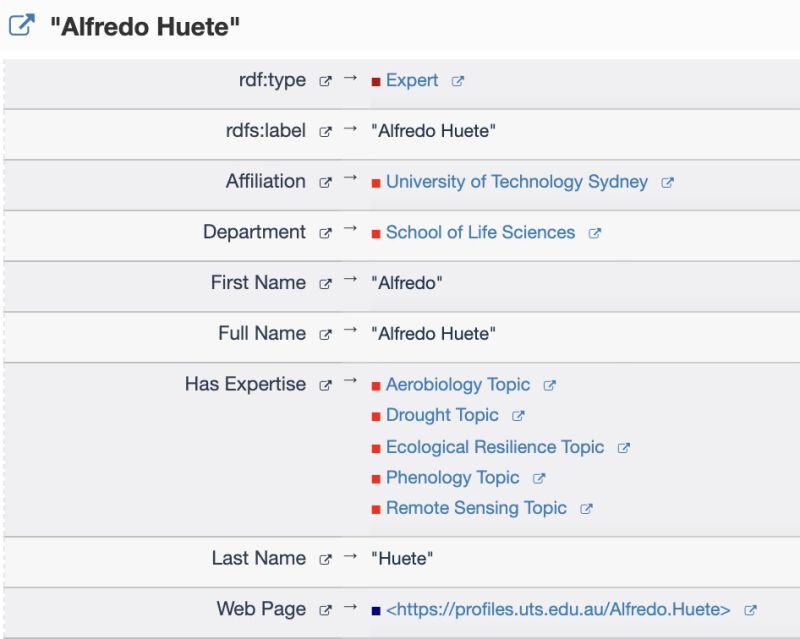
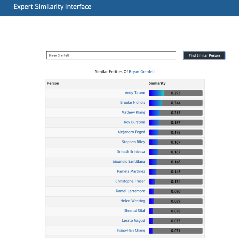
Mutiple research topics are involved in this project, including knowledge graph construction, ontology engeneering, event detection, causal relation identification, expert-expertise match, knowledge graph summarization, and data integration, etc. Paricularly, I am working on developing approaches to matching experts and expertise and identifying causal events by using pre-trained language models. Additionally, I also help on designing ontologies for domain datasets and help triplify those datasets into our seed graph.
More details and demos be found on our project website . One example of using our services for humantarian aid is shown below (Please refer to our paper for more details.):

3. Research Assistant on an NSF Rapid Grant
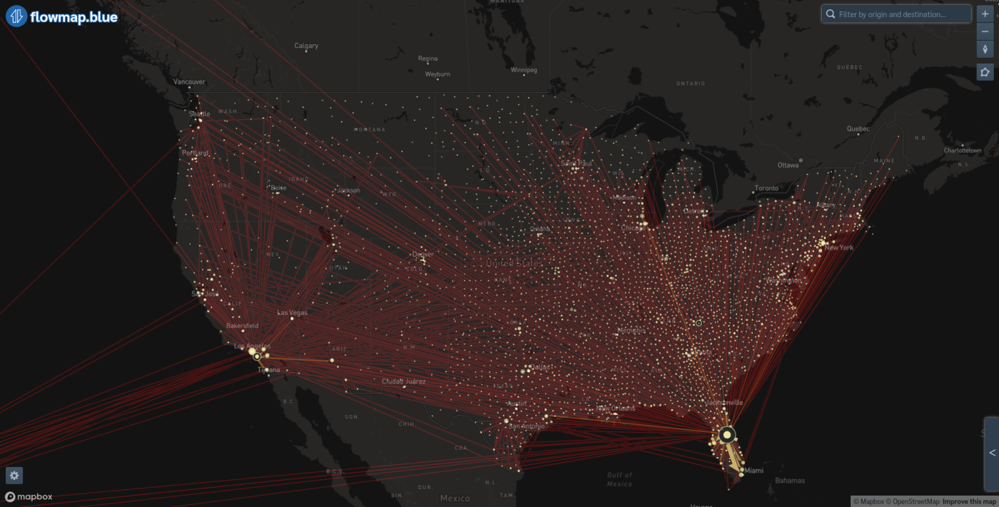
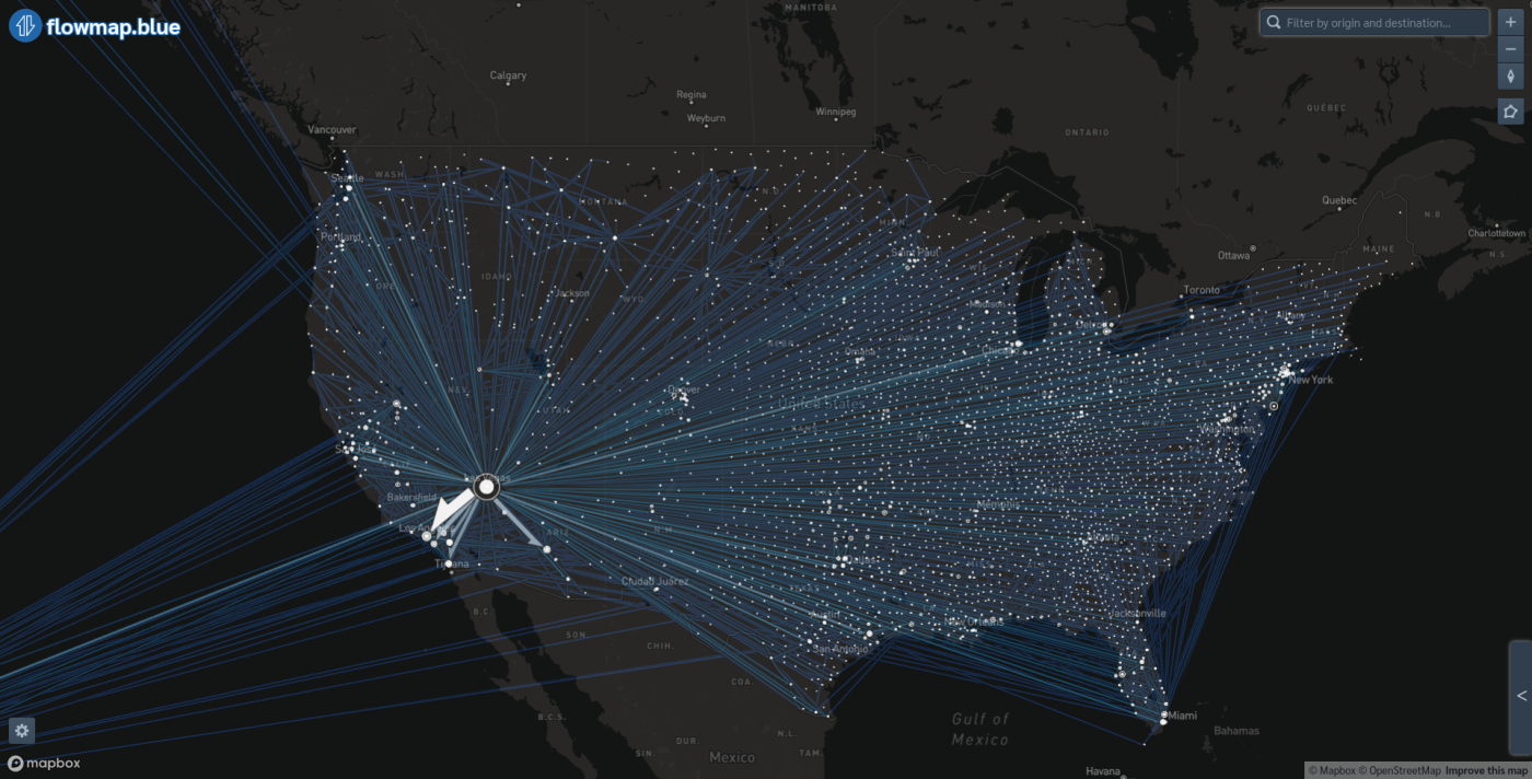
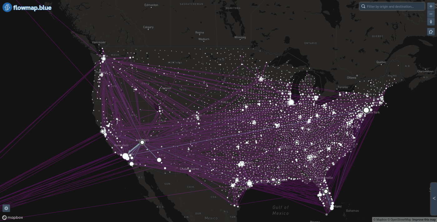
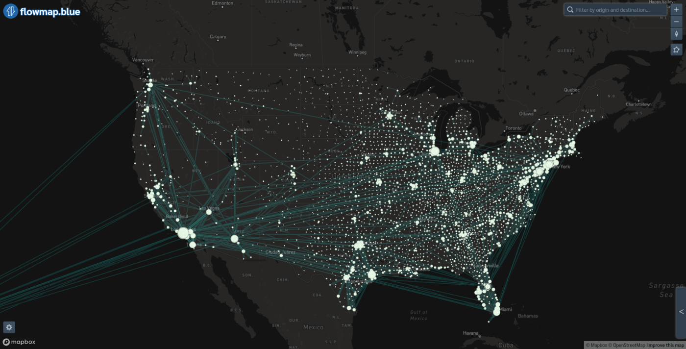
In this project, we focused on studying the ever-changing role of different places in spreading COVID-19. During the recent COVID-19 pandemic, many coronavirus-related complications have shown to be tied to super-spreader individuals and super-spreader events such as the October convo-cation events at Charlotte church and the February conference by the drug company Biogen. Those examples reveal that virus transmission is more ikely to happen at places of certain types (e.g., churchesand bars) than others. Therefore, identifying super-spreading places is crucial to the government and policymakers, so that place/place type-centric policies can be enacted effectively.
We designed an index to quantify the risk of different place types, which considers three basic features of a place – visit frequency, area, and duration of visiting. Moreover, humans are mobile and the risk of places are directional. Residents may travel to high-risk places in other counties and bring the virus back to their home counties, thus resulting in cross-region virus transmission. This implies that the total risk in a county may not only be determined by people’s visit to high-risk places in their home county but may also be largely influenced by visiting high-risk places outside. We are interested in the following questions: Q1:which types of places have more external influence/risk? Q2:which counties are affected more by places outside? and Q3:which counties influence other counties more?
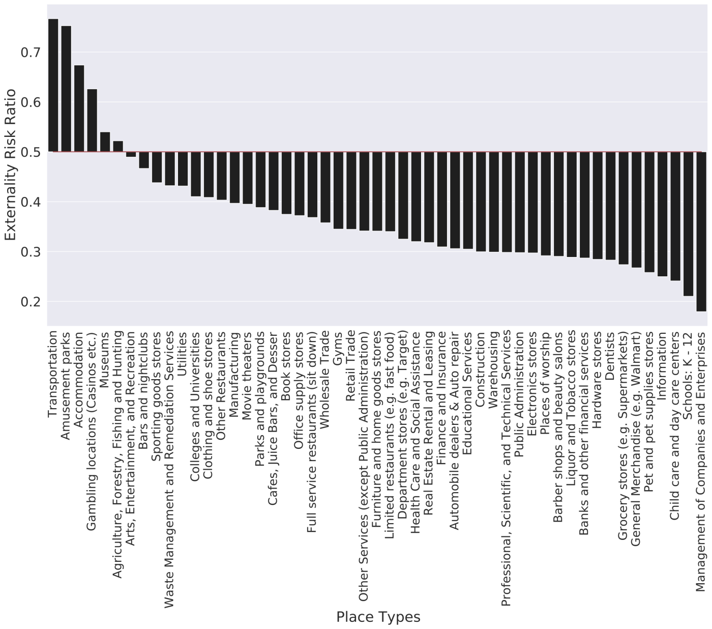
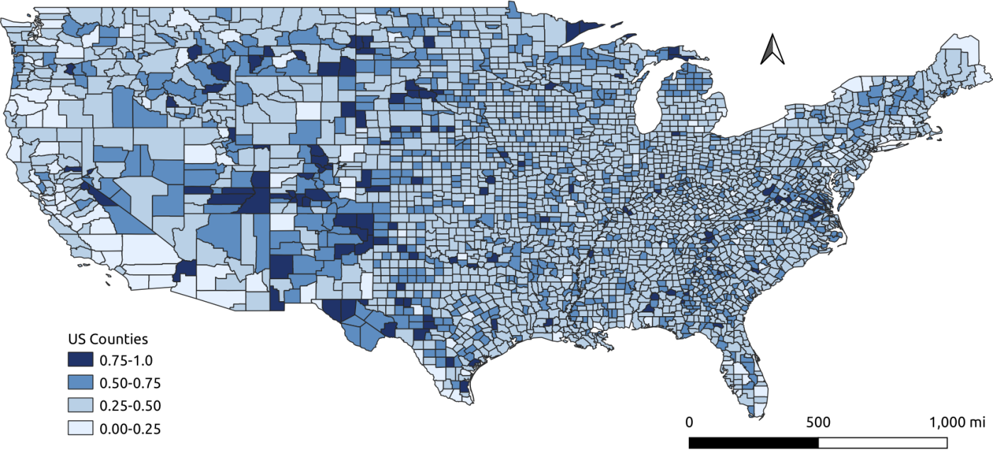
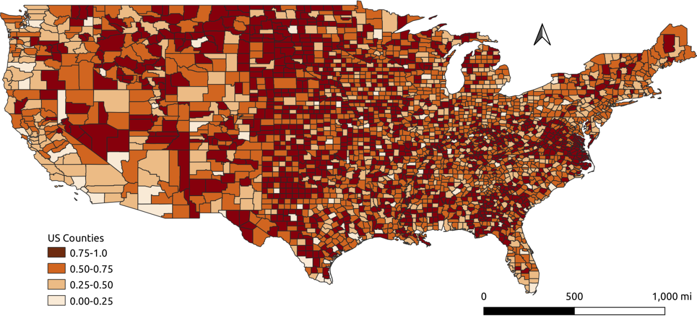
Four risk flow maps across the US in terms of different place types. Counties are represented as nodes and the size of anode is determined by the total risk of a county, and the risk transmitted from one county to another is represented by edges with thewidth of edge representing the amount of risk.
4. Research Assistant on an NSF Project - Open knowledge Network
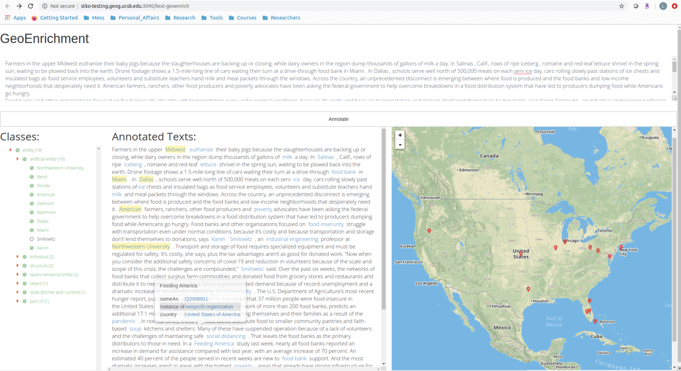
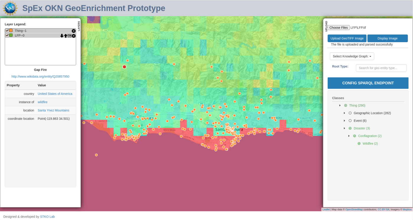
Knowledge graphs consist of interlinked pieces of information about our world. Everything happens somewhere and at some time and knowing where and when things happen is critical to understanding why and how they happen. This project focuses on using space and time as nexuses to connect data across different domains, multimedia formats, and perspectives by using knowledge graph technologies. The resulting knowledge graph enables users to ask complicated domain questions and arrives at a more holistic understanding of complex physical and social processes. We developed text-based and image-based enrichment tools to enrich news articles and images with open knowledge graph (such as Wikidata).
